The descriptions in this site guide of flying conditions to be expected reflect the experience of the authors of the guide. The conditions that you encounter at the site may differ from those encountered by the authors. The descriptions of their experiences may not be relevant to the likely experience of any other pilot, particularly one who is relatively inexperienced or new to the site. A decision to launch is always that of the individual pilot. In reaching a decision a pilot may wish to take into account the descriptions in this site guide but must also consider numerous other factors including the pilot’s training and experience, familiarity with the site, equipment, physical and mental condition and the specific conditions in existence at the time of the decision. Pilots of relatively little experience or who are new to the site are urged to consult with other pilots at the site to obtain their assessment of the conditions.
The most frequently used flying sites are Pine Mountain and Pine Ridge.
Telegram group of Central Oregon here
Central Oregon Flying Sites
——————————CLOSURE—————————–Pine Mtn Rock L Closed
Pine Mtn Rock L Closed until further notice. Please use the Freedom Launch or contact local pilots via telegram or email for more infomation
Pine Mtn. Rock L – CLOSED
- Pine Mountain
- North Side
- Rock L (below)
- Freedom
- North Side Summit
- West Side (not recommended)
- South Side (not recommended)
- North Side
- Pine Ridge
Central Oregon Closed Sites
The sites below were once used and have been closed due to landowner requests. Please be respectful of the landowners wishes and help paragliding keep a good reputation here in Central Oregon.
Pine Mountain – Rock L
TEMPORARILY CLOSED
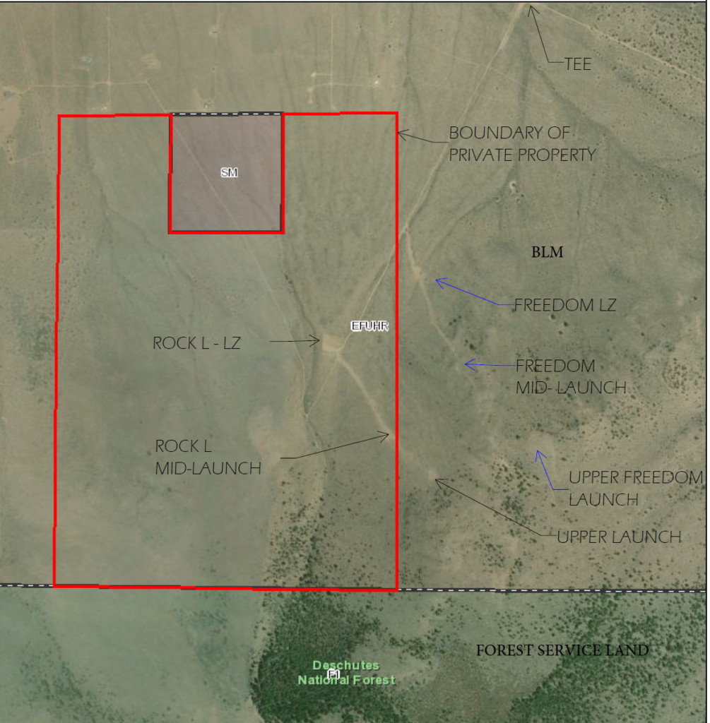
also known as mid-launch, raquel
(see map below for boundaries of private property)
Pine Mountain – North Side launches
Freedom – mid launch
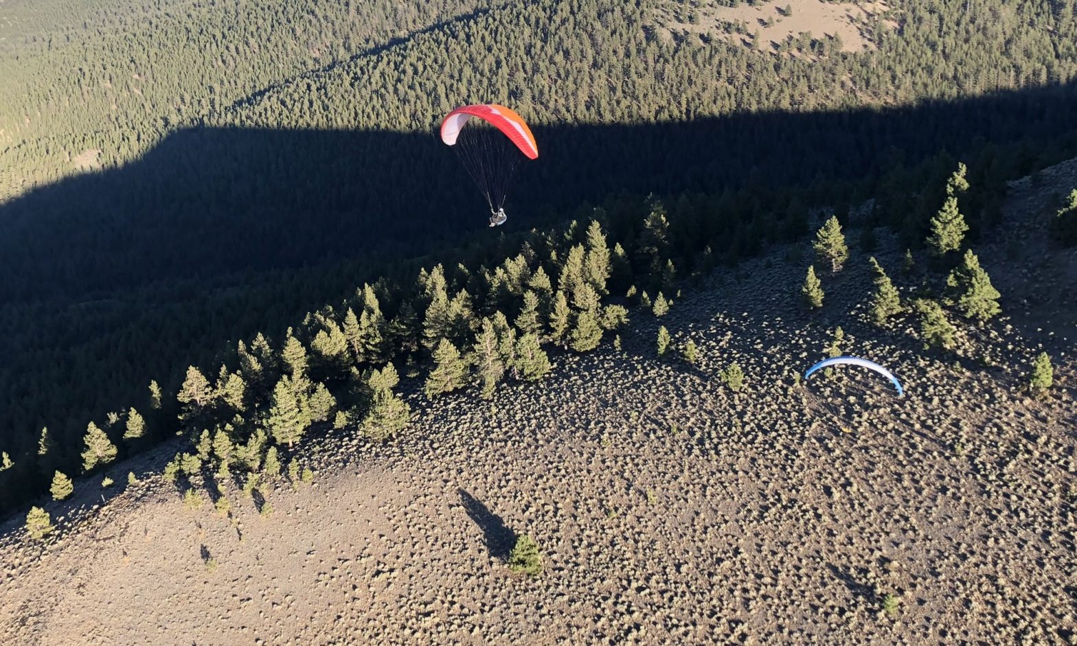
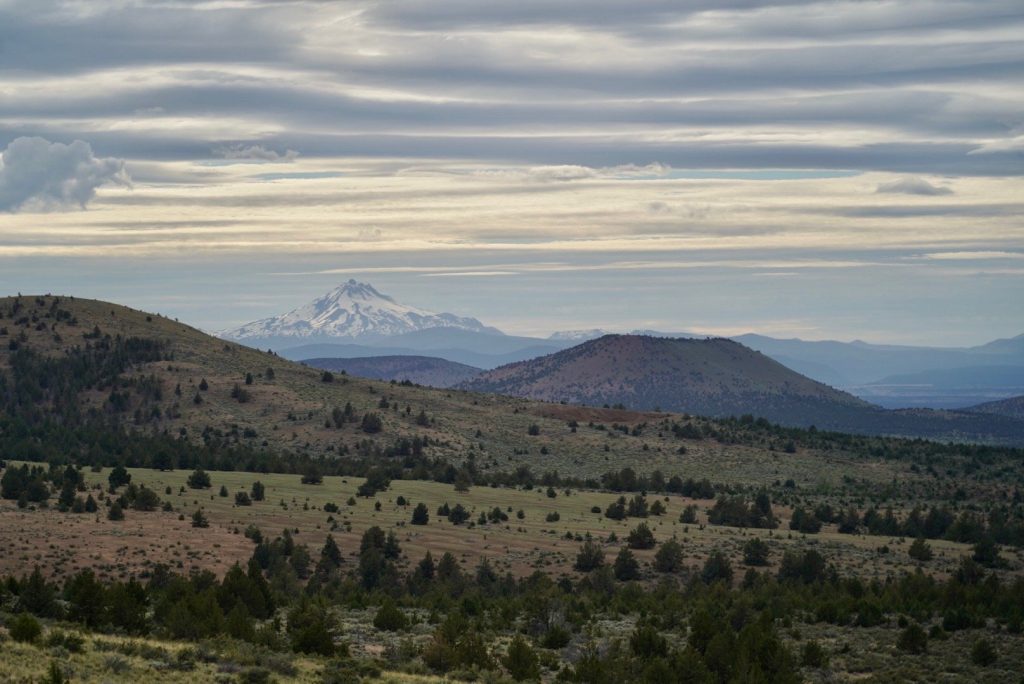
Pine Mountain is located in the “High Desert”, 26 miles east of Bend. With an altitude 6,407′, ideal climate. Its desert thermal conditions and ridge soaring are a formula for excellent paragliding. Depending on the amount of snow, it can be flown all year. Extreme caution should be taken when flying “Pine” during the summer — it is a desert thermal site and flying midday can be extremely hazardous.
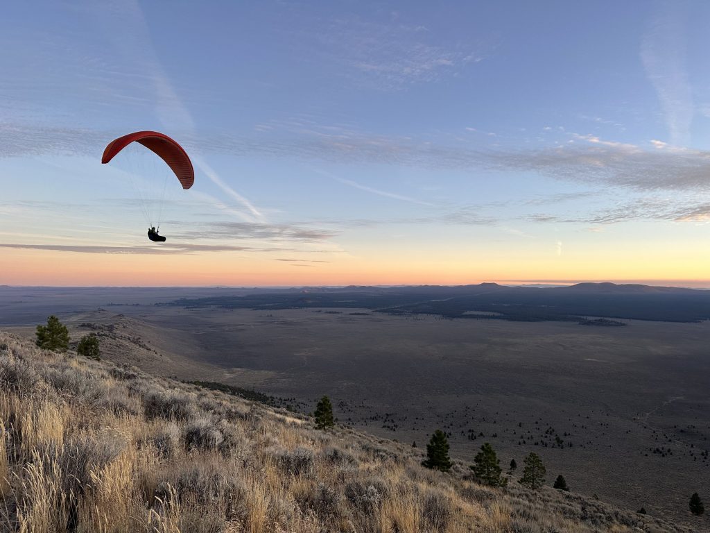
The upper and freedom LZ and launches are located on the North side (front side) of Pine Mountain. These sites are typically used for evening paragliding but occasionally used for mid-day flying as well. These launches are both on BLM land. Please connect with the telegram group to get more information regarding these launches. Launching and landing inside the private property boundary is currently off limits, closed to any kind of activity. Please stay within the BLM and Forest Service boundaries.
Landing in the Freedom parking area can be difficult. If you are a newer pilot it is recommended to land anywhere down the road as needed. It is open desert and you can land anywhere along the entrance road all the way to the “T” on BLM land. The “T” is the easiest landing zone.
Pine Mountain Flying Guidelines
Guidelines:
1. Respect Millican Valley landowners and avoid landing on private land.
2. Be aware of stock and wildlife. Leave space between you and wild or domestic animals when launching, landing, and flying.
Suggested flight plan from the top of Pine is very similar to the hang gliders search pattern:
1. Launch from the paragliding launches instead of the hang launch, especially when there is any northern component to the wind or cycles. This will give you a little extra altitude to get around the corner below the peak of Pine.
2. If you can’t find a thermal to sustain or climb out over the top of Pine using the west face or the northwest rock spine, work your way down the training hill spine. If you get low on the west face it would be best to side hill land and hike back up.
3. If you sink out using this search pattern you can easily land at the Rock “L” landing zone or anywhere in that area leading to the “T” landing zone that the hang gliders use.
Some hints for flying glass-off from the training hill:
1. Be extra careful of your penetration when benching up. You should plan on crabbing towards the Y if conditions strengthen to avoid blowing over the ridge.
2. Turn right after launch and work the East spine until you are even with the top of the ridge. Then cut over the upper launch to the pines at the top of the ridge. From there, check strength and work back into the canyon below the tall pines. Turn N, check again and then make a final turn up to the trees. If the conditions have an east component (NE), work the opposite side of the canyon below the spine.
3. Read Frankie and Phil’s article Pine Mountain Strong Wind Glass-off Techniques.
© 2023 Desert Air Riders