Pine Ridge
Terrebonne, OR
Public Lands [US Forest Service]
Pine Ridge
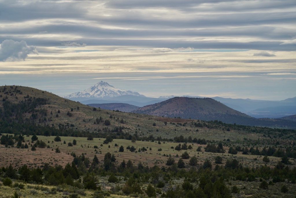
Located 13 Miles NorthEast of Terrebone, OR. At 4200′ ft with amazing panoramic views of the cascade mountain range. This ridge is known for great ridge soaring and glass-off evening flights. The site also has great options for uphill kiting practice. In the warmer months XC flights can be linked to Gray Butte, Grizzly Butte, Haystack, & Beyond!
Site Rating
P-2
LZ Coordinates
44.429484, -121.062862
Launch Coordinates
44.426662, -121.062161
Ideal Wind Direction
303.75 – 326.25 NW
Wind Speed
MIN-5 MPH
MAX 15MPH
Max Gust Factor
5 MPH
How To Get There
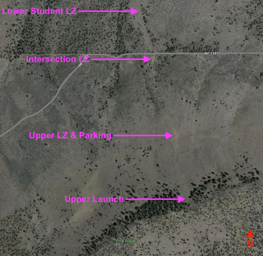
There are a few ways to get to Pine Ridge. The following is the most direct and easiest route for smaller cars like subarus. Put these coordinates into google maps 44.429739, -121.034082 . This will take you to Forest Road FR-1395 from wherever direction you are coming from. [Warning using the LZ/Parking coordinates for directions will take you through Skull Hollow where there is one really rough section.] From here you will head due west on the dirt road for about 1 mile to a left hand turn. Located here 44.433512, -121.062833 . The Parking lot and LZ are shown on the map here. Try to park against a fence as the parking area is also the favored LZ for a lot of pilots. Try not to burn out or tear up the parking area. It would only cause problems with the Forest Service and our use of the site.
Note: The road is a bit rough. Some of the cattle guards have eroded quite bad and hitting one at speed would cause damage to your car. Also the area is very active with people target shooting, mountain biking, and hiking/running. So be respectful and careful.
Launch
44.426662, -121.062161
Launch here is directly above and south of the parking area. You will pass through the gate and head up the well worn trail. The actual launch depends on wind strength. Typically pilots will wither hike or kite up from the gate only as high as they need to launch. On weaker days pilots will launch from the very top of the ridge between the gap in the trees. On stronger days you can launch just a few steps up the hill after going through the gate. The hill is grassy and great for ground handling. There are many semi flat areas along the trail on the right or left that can be used for laying out and launching
Note: Most accidents in Central Oregon are due to strong wind and/or underestimating the wind strength. Know your capabilities & wing loading before launching.
Landing “LZ,”
44.429484, -121.062862
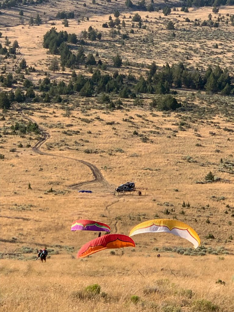
A lot of pilots like to land at the parking area. It is a tricky down slope landing with lots of obstacles. Cars, barbwire fencing, big sage bushes, trees, etc. But it does work quite well. Just make sure you scope everything out on the ground beforehand.
There are two other “regular launches” as well. One is located at the left hand turn “intersection” listed in the directions section above. 44.433512, -121.064314 . The other is about 1/2 mile to north directly below the left hand turn in a wide open grassy area.
Landing at “The Intersection” can be tricky. The trees are pretty thick and it is also sloping downhill. If you overshoot this landing and are low, there is a fence and a lot of trees to hit near the LZ.
The Lower Open Grassy field area is by far the easiest LZ. It is often used by newer Pilots and students. It is located here: 44.435745, -121.065590 . There is a ranch gate that can be used to retrieve pilots by car down there. Just be respectful and close the gate after you leave.
Site Intros
For a site intro, hit up the local chat and connect with a local
Flying Pine Ridge
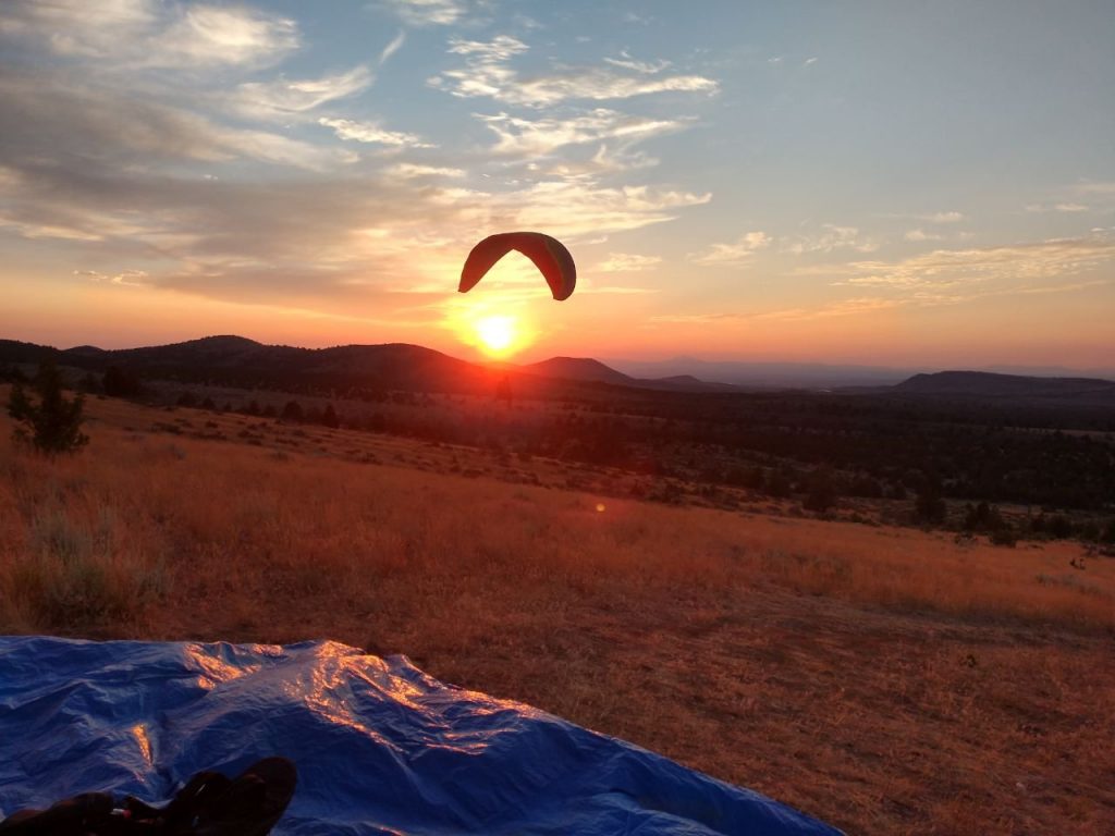
Pine Ridge is primarily mechanical lift ridge soaring and can be flown year-round with a N to NW wind around 5mph-15mph. In the warmer months ridge soaring is often combined with thermals and glass-off conditions. The glass-off conditions here can cause bouyant air throughout the area for many miles in all directions. Where it commonly requires pilots to use decent techniques to even get down. It can prove to be very hard to get down for novice pilots.
There can be a significant wind gradient and conditions can change rapidly. After launching make sure to stay out front at first and check your penetration before working your way up and back into the stronger lift band people have been blown over the back here and many nights you can find yourself standing on full bar just to stay out front.
The ridge Can get pretty crowded on good nights. With many gliders in the lift band it is important to keep your head on a swivel looking out for other gliders and use the standard “Rules of the Ridge” to avoid collisions.
Hazards and notes:
Be Aware of changing conditions and wind gradients.
The west end of the ridge faces moe west than the rest of the ridge and peels into Skull Hollow. This is a minature canyon that sits on the west end of the ridge. It has a strong venturi effect as wind is compressed and forced through the canyon. Flying low and too far to the west can result in getting sucked into the canyon.
If you find yourself not being able to pentrate or worse being blown back. But have enough height and distance in front of the ridge, a plan B option is to crab to the east where the ridge drops away. As the ridge gets smaller you will slowly drop outy of the lift. Once past the ridge to the east you can find another LZ here: 44.430039, -121.o45270 . The lift will be much less here and the consequencs of blowing back are much less. Note: This LZ is an active gun shooting area. Be aware of people in the area before you use it.
For Emergencies call 911 or Activate your S.O.S Personal locator beacon.
Disclaimer & Terms of Use
Last updated on May 26, 2023
The information provided by the Central Oregon Hang Gliding and Paragliding Association on Desertairriders.org is for general purposes only. Should you choose to read and use any information provided, do so at your own risk. Prior to setting out check current weather, conditions, and land/road closures. While flying, obey all public and private land use restrictions and rules, carry proper safety and navigation equipment. The information found herein is simply a planning resource to be used as a point of inspiration in conjuction with your own due-diligence. All information on the Site is provided in good faith, however we make no representation or warranty of any kind, express or implied, regarding the accuracy, adequacy, validity, reliability, availibility, or completeness of any information on the Site.
UNDER NO CIRCUMSTANCES SHALL WE HAVE ANY LIABILITY TO YOU FOR ANY LOSS OR DAMAGE OF ANY KIND INCURRED AS A RESULT OF THE USE OF THE SITE OR RELIANCE ON ANY INFORMATION PROVIDED ON THE SITE. YOUR USE OF THE SITE AND YOUR RELIANCE ON ANY INFORMATION ON THE SITE IS SOLEY AT YOUR OWN RISK.